Enabling computational modeling and geospatial data analysis through HUBzero
Category
Published on
Abstract
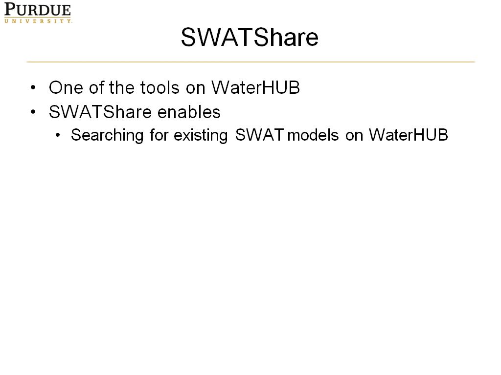
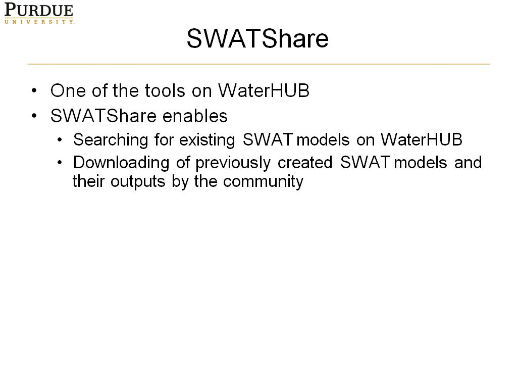
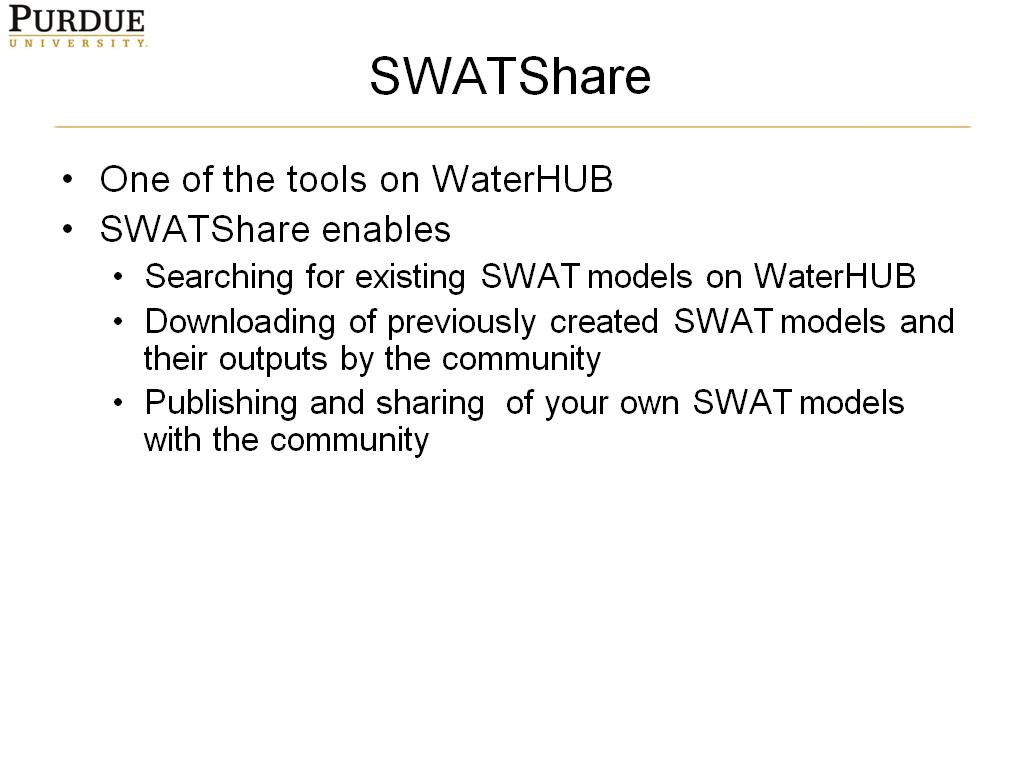
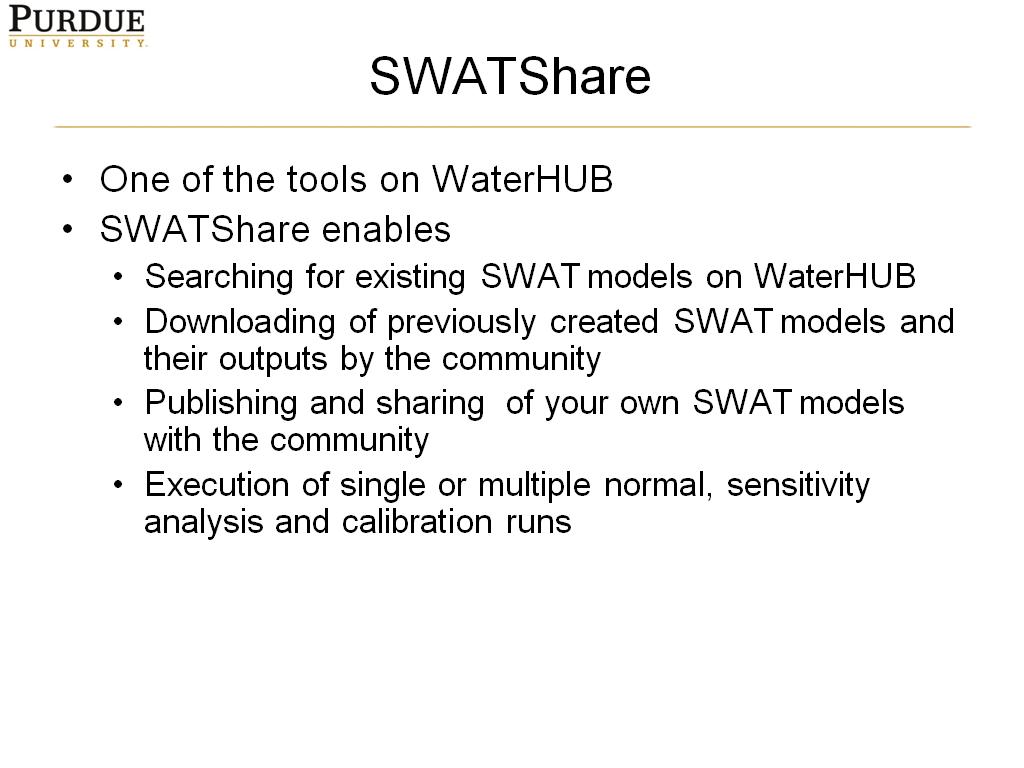
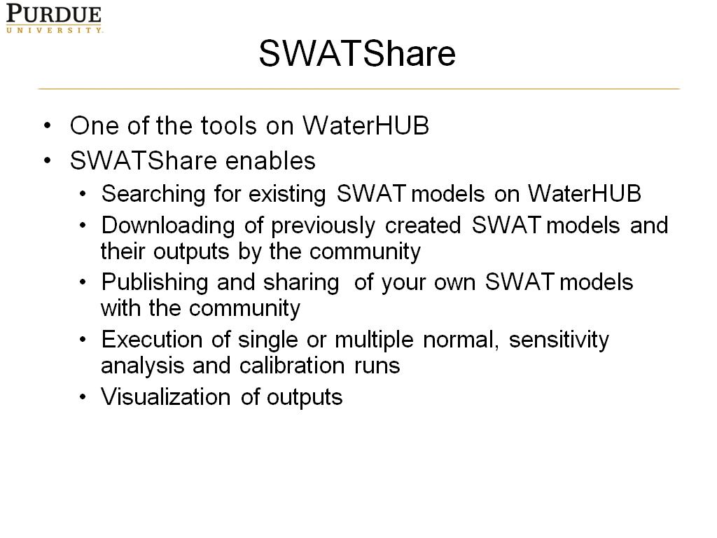
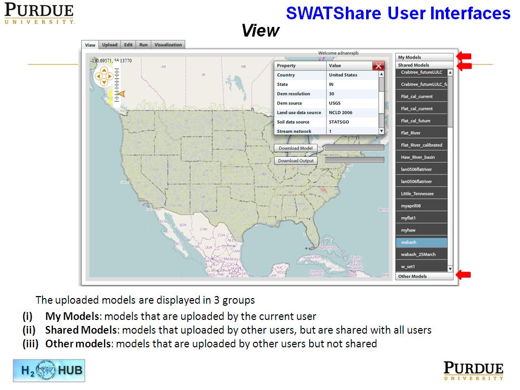
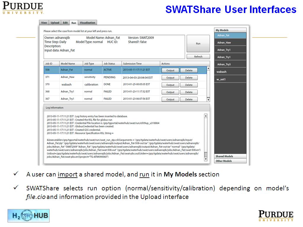
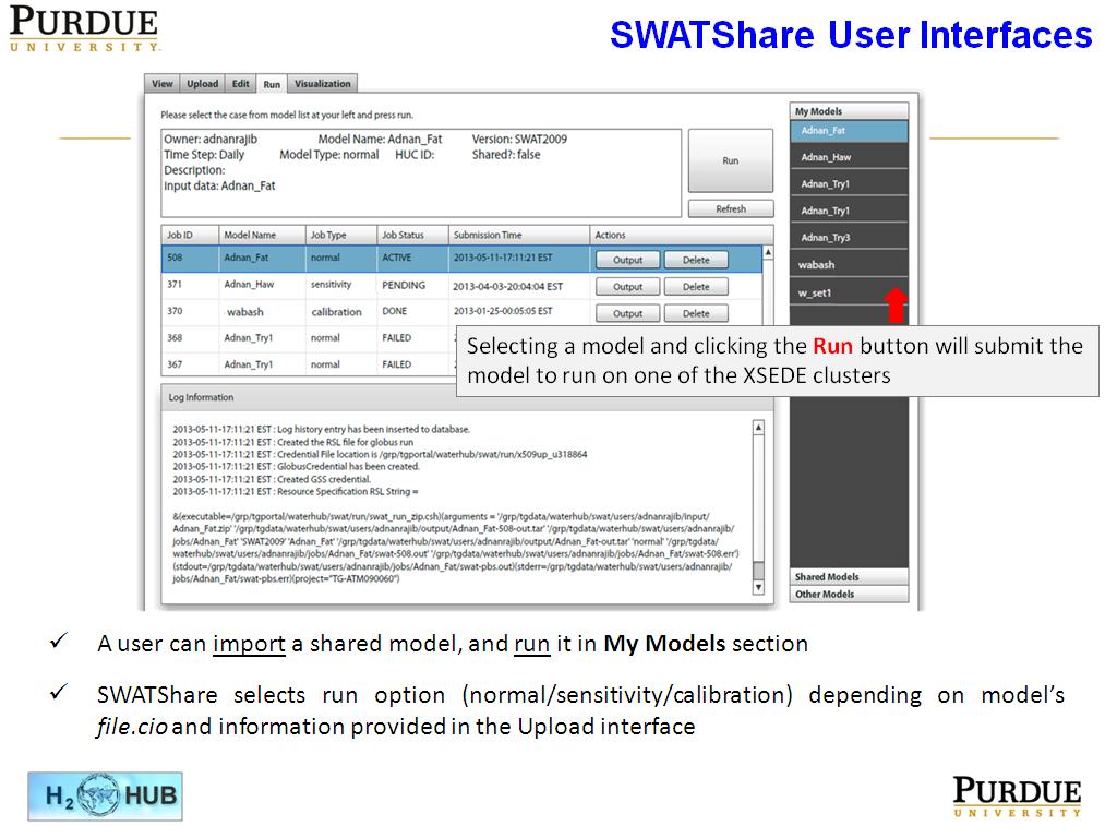
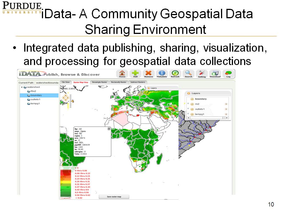
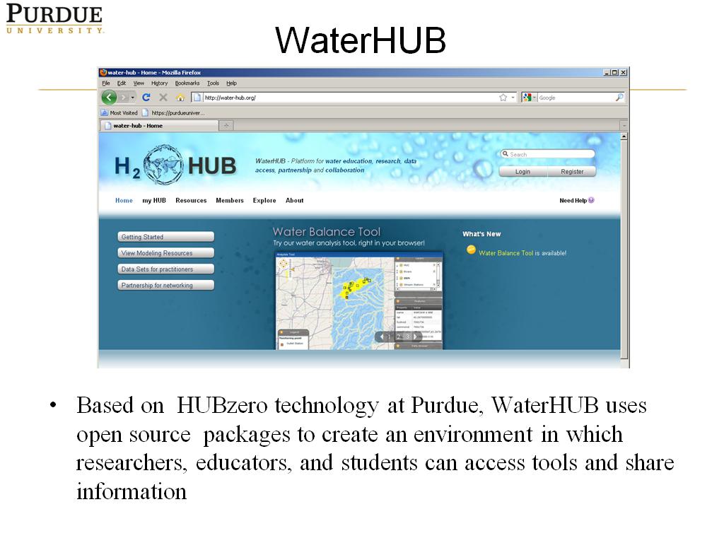
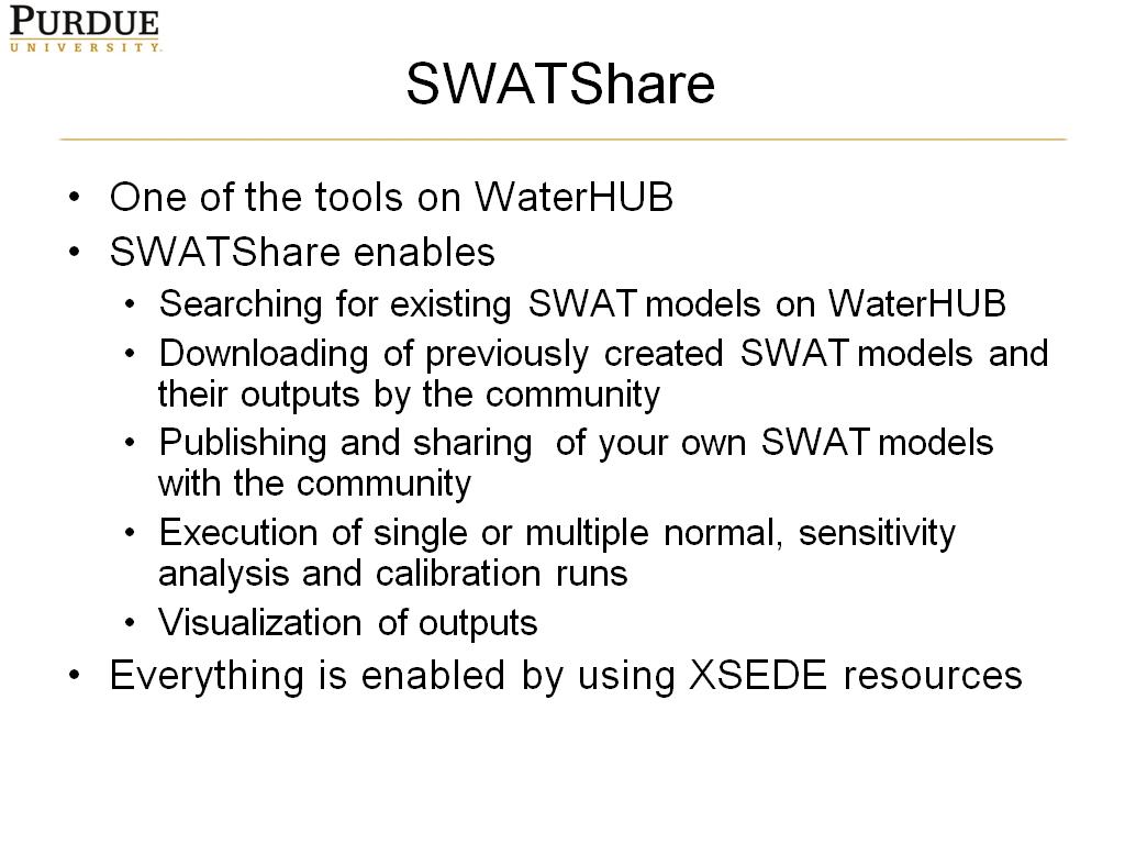
Water-HUB is developed as a collaborative platform for hydrology researchers, educators and policy makers. Currently, a commonly used hydrologic model called Soil Water Assessment Tool (SWAT) is used to link hydrologists through a SWATShare interface on Water-HUB. SWATShare enables any hydrologist to publish, share, execute, and visualize SWAT model for any watershed in the United States. The SWATShare tool builds on top of the HUBzero web platform and is implemented using an extensible layered system architecture including a FLEX based GIS user interface, a set of geospatial data and modeling services, and XSEDE HPC resources at the backend. It extends the core HUBzero software stacks to bring large scale geospatial data and modeling capabilities into HUBzero. Development and application of SWATShare has demonstrated that the capabilities of managing and sharing temporal and geospatial data can be applied to any model. However, there are currently no easy ways or tools to develop such data sharing and managing capabilities within HUBzero. This presentation will describe the architecture behind SWATShare, and discuss some new efforts to develop generic software building blocks that will enable integrated geospatial data/model publishing, analysis, and visualization through HUBzero, allowing more domain researchers and students to collaborate through online geospatial interactive applications.
Bio
Dr. Venkatesh Merwade is an associate professor in the school of civil engineering at Purdue University. His research and teaching interests include solving of water resources issues by using geographic information systems, computer modeling and hydrologic information systems. Currently he is working on projects related to flood modeling and mapping, soil moisture data assimilation and cyberinfrastructure development for hydrology.
Cite this work
Researchers should cite this work as follows:
Submitter
Nikki Huang
Purdue University
Tags

-
 1. Enabling computational modelin…
0
00:00/00:00
1. Enabling computational modelin…
0
00:00/00:00 -
 2. WaterHUB
71.171171171171167
00:00/00:00
2. WaterHUB
71.171171171171167
00:00/00:00 -
 3. SWATShare
95.7957957957958
00:00/00:00
3. SWATShare
95.7957957957958
00:00/00:00 -
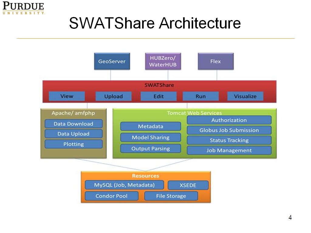 4. SWATShare Architecture
266.86686686686687
00:00/00:00
4. SWATShare Architecture
266.86686686686687
00:00/00:00 -
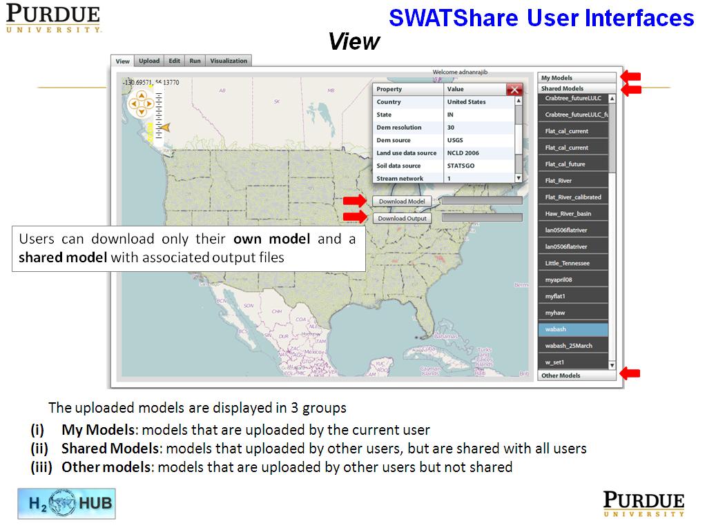 5. SWATShare User Interfaces
314.48114781448118
00:00/00:00
5. SWATShare User Interfaces
314.48114781448118
00:00/00:00 -
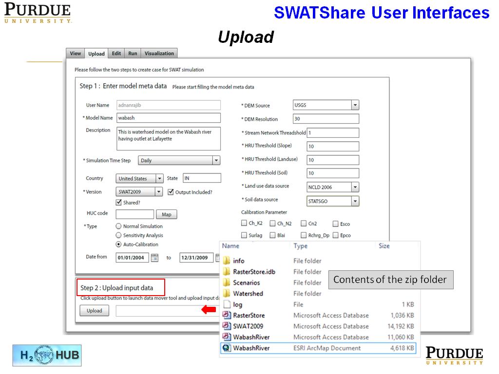 6. SWATShare User Interfaces
469.86986986986989
00:00/00:00
6. SWATShare User Interfaces
469.86986986986989
00:00/00:00 -
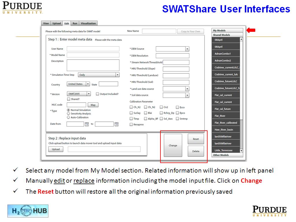 7. SWATShare User Interfaces
588.8221554888222
00:00/00:00
7. SWATShare User Interfaces
588.8221554888222
00:00/00:00 -
 8. SWATShare User Interfaces
649.84984984984987
00:00/00:00
8. SWATShare User Interfaces
649.84984984984987
00:00/00:00 -
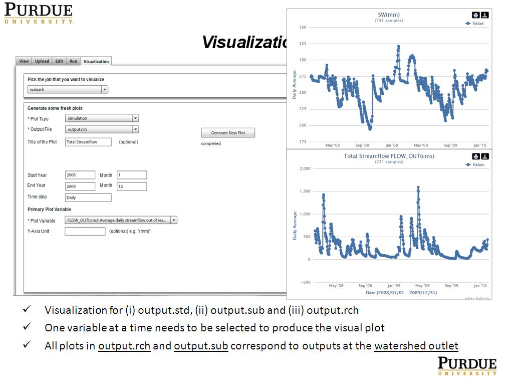 9. Visualization
680.21354688021358
00:00/00:00
9. Visualization
680.21354688021358
00:00/00:00 -
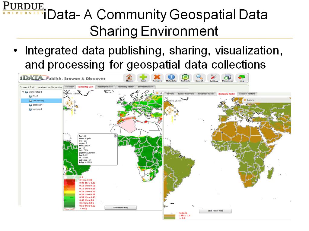 10. iData- A Community Geospatial …
742.208875542209
00:00/00:00
10. iData- A Community Geospatial …
742.208875542209
00:00/00:00 -
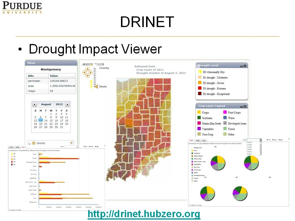 11. DRINET
824.09075742409084
00:00/00:00
11. DRINET
824.09075742409084
00:00/00:00 -
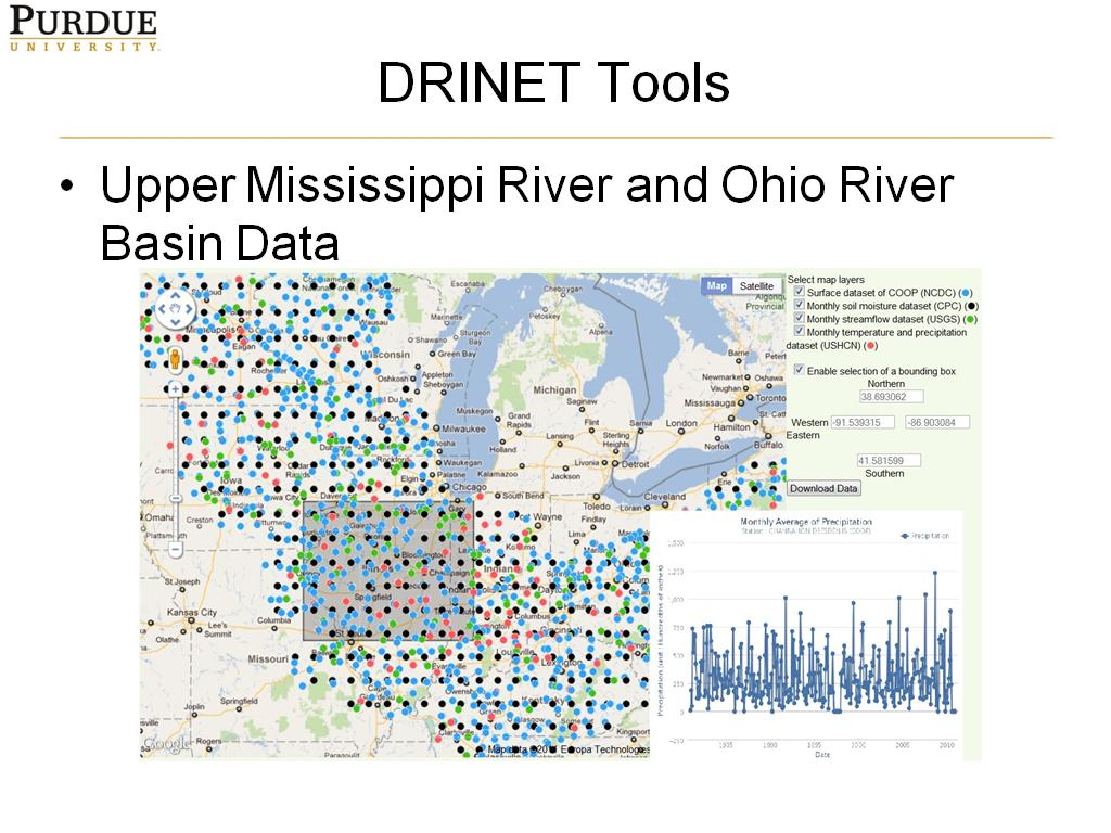 12. DRINET Tools
872.00533867200534
00:00/00:00
12. DRINET Tools
872.00533867200534
00:00/00:00 -
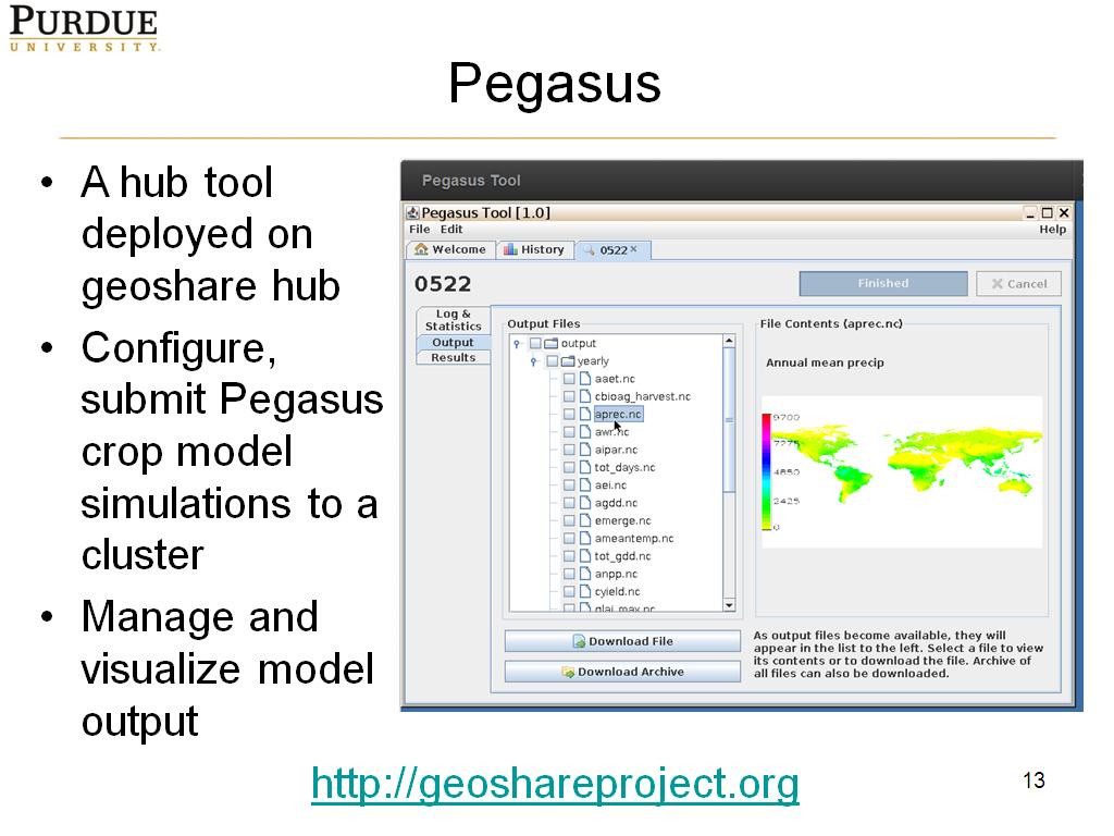 13. Pegasus
895.39539539539544
00:00/00:00
13. Pegasus
895.39539539539544
00:00/00:00 -
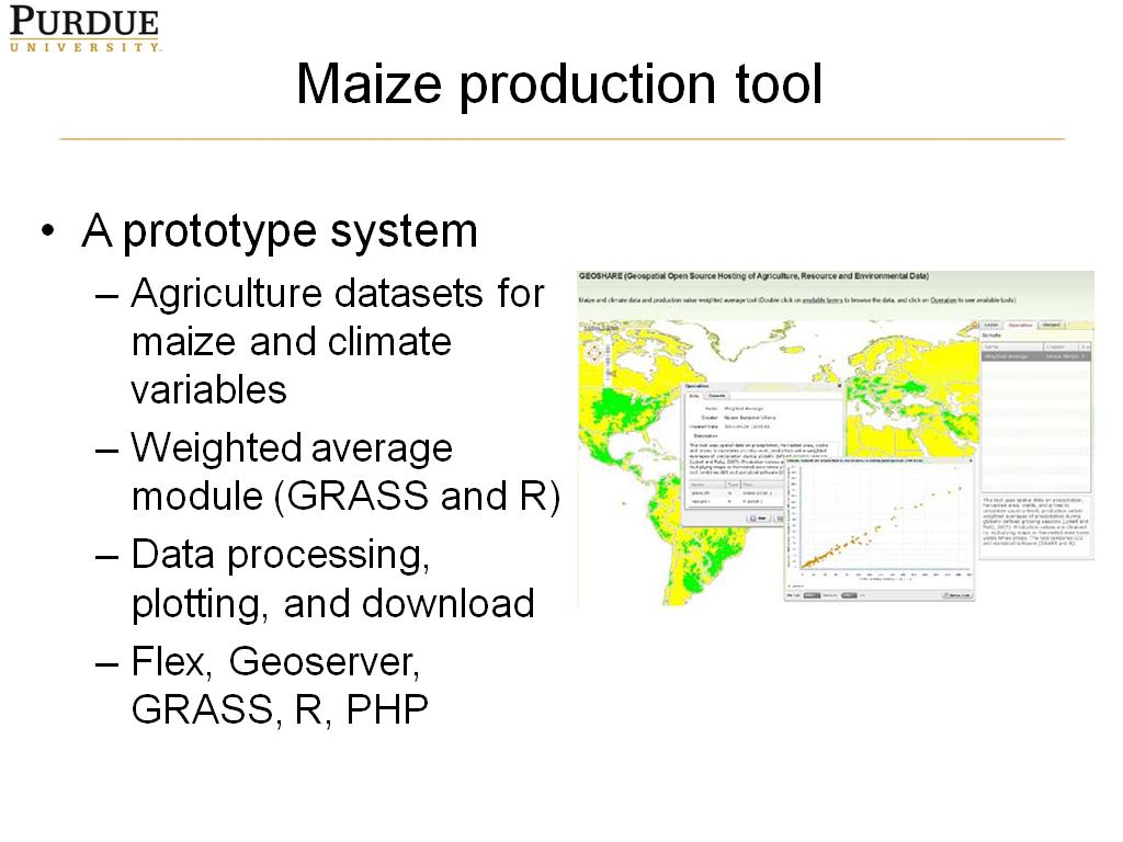 14. Maize production tool
928.39506172839515
00:00/00:00
14. Maize production tool
928.39506172839515
00:00/00:00 -
 15. GABBS
982.18218218218226
00:00/00:00
15. GABBS
982.18218218218226
00:00/00:00 -
 16. Summary
1027.2939606272939
00:00/00:00
16. Summary
1027.2939606272939
00:00/00:00 -
 17. Thank you!
1067.1338004671338
00:00/00:00
17. Thank you!
1067.1338004671338
00:00/00:00